Royal Navy Mapmakers Left Their Mark
The recent passing of HRH Queen Elizabeth II and numerous comments made online and in letters to the editor about the British influence on our history—coming at a time of truth and reconciliation—set me to thinking.
There are 350,000 place names on Canadian maps, 50,000 of them in British Columbia. Of the 1000’s that identify our Pacific Coastline, most—indeed, almost all—were coined by officers of the Royal Navy.
It was a daunting task even for those vaunted “iron men in wooden ships”.
The B.C. coast, as the crow flies, is approximately 954 km (593 miles). But when you allow for its indentations and over 40,000 islands, it’s over 25,725 km or 15,985 miles—a tenth of all of Canada’s coastlines.
Charting and naming these 10’s of 1000’s of features—bays, inlets, islands, rivers, reefs and on and on—took decades of dedicated, often dangerous, work and is, in fact, an ongoing task. But it was the officers and crews of the Royal Navy’s handful of survey ships that did the heavy lifting at incredible personal discomfort.
The modest Sir George Henry Richards, KCB, FRS, who surveyed and named 1000’s of features of the British Columbia coastline, never named a single geographical feature after himself. —Wikipedia
The result of their work still stands.
Most of their pioneering navigational charts continue in use today; work that’s vital to the safe navigation of some of the most treacherous waters to be found anywhere. Thanks in great part to their efforts, coasts that were notorious for shipwreck are no longer threats to life and limb when navigated with due diligence.
All thanks to these British tars who, for the most part, are unnamed and unsung.
* * * * *
Regretfully, 99.9 percent of these British-origin names on our charts came at a cost to our original hydrographers, the province’s coastal First Nations. Only a few geographical names have survived in both languages (and these are often subject to the challenges of interpretation, pronunciation, spelling and, latterly, correction).
We even some features that are hybrids, such as Skookumchuck Narrows on the Sunshine Coast to name but one which is derived from the Chinook trading jargon, a patchwork of European and Indigenous languages.
Some names take their inspiration from their physical features, like Race Rocks for its strong tidal flows, as do the Trial Islands, and Ripple Rock which was notorious for more than rippling when in full flood!
But 1000’s of coastal names owe their origins to the hydrographers’ British background. First and foremost, of course, was royalty (Victoria, Royal Roads, Albert Head), leading British politicians and soldiers (Cape Palmerston, Wellington), the Old Country (New Westminster, New Caledonia), the hydrographers’ own family and friends, fellow naval officers (Robson Bight, Palliser Rock, Port Hardy), leading actresses (Lulu Island)—even a celebrated race horse or two.
Or historic events and tragedies, such as Grappler Inlet and any of the numerous Deadman’s Creeks or Rivers.
* * * * *
From 1795 until 2001 hydrography, the task of creating navigational charts, was the work of the Hydrographer of the [Royal] Navy under the working departmental name of the United Kingdom Hydrographic Office. Since 2001 this mandate which now combines hydrography and meteorology, is performed by staff of the Devonport Flotilla at HMNB Devonport.
In Canada we have the Canadian Hydrographic Service. According to its website the CHS “ensures that the required charts and nautical publications are available, accurate and authoritative.”
The CHS “provides crucial and detailed information to departments, agencies, organizations, and groups impacted by or taking measures in response to marine pollution. The CHS's role in safety of navigation also provides further protection to our marine beds and sea life, by reducing the risks of accidents that could be the cause of a pollutant spill.
Boaters, large and small, stake the safety of their vessels and their lives upon the accuracy of navigational charts first drawn by the Royal Navy hydrographers of old. —Canadian Hydrographic Services
—Thousands of commercial vessels navigate Canadian waters every year. Commercial shippers rely on CHS charts and publications to ensure the safe and efficient navigation of their vessels.
—Recreational boaters rely on our charts to navigate safely and avoid injuring themselves or their guests, or grounding and damaging their vessels.
—Fishers rely on our charts and publications not only for safe navigation, but also as tools to help locate fish. Classification of the sea floor and contours can help local fish. Classification of the sea floor and contours can help locate fish populations and track migrations. Special nautical charts have also been developed exclusively for recreational fishers and boaters.
—Through various agreements, CHS provides hydrographic services and special surveys and charts to the Department of National Defence (DND) and to the North Atlantic Treaty Organization (NATO) member states.
—Nautical charts, detailed information on tides, currents and other features are crucial to SAR operations at sea. The Canadian Coast Guard and other organizations involved in SAR operations rely on CHS’s products.
—The CHS provides information that is important to the exploration for oil, gas and minerals. These activities require precise measurements and accurate forecasts of tides, currents, water levels, bottom types and contours.
—Information collected by the Permanent Water Level Gauging network of the CHS is essential in measuring sea level rise, an important aspect of climate change.
—Finally: The CHS provides crucial and detailed information to departments, agencies, organizations and groups impacted by or taking measurements in response to marine pollution. The CHS’s role in safety of navigation also provides further protection to our marine beds and sea life by reducing the risks of accidents that could be the cause of a pollutant spill.
* * * * *
Somewhat surprisingly, this cairn commemorates Captain Walbran in Walbran Hill Park, Victoria. Few of his professional colleagues have been so honoured for their services and sacrifices. —Focus on Victoria
But, today, I’m acknowledging the pioneer hydrographers of the Royal Navy (with a tip of the hat to their Spanish counterparts), from Capt. George Vancouver on, the all but invisible mapmakers of old. You can learn much more from Capt. John T. Walbran’s classic book, British Columbia Coast Names, originally published in 1909 and reprinted in 1971. It’s still the Bible of B.C. coastal place names.
Walbran didn’t start out as a hydrographer but as a merchant master mariner who first was employed by the Canadian Pacific Navigation Co. before he joined the Canadian Hydrographic Service.
Another treasure source of place names (mostly inland) is 1001 British Columbia Place Names, published in 1981, by G.P.V. and Helen B. Akrigg.
Walbran goes into some detail with some of his entries but the Akriggs keep their chapters short and sweet.
I always prefer a good story with my geographic place names and I’ve written about several 100 of them over the years. Since the Chronicles is meant to be almost anything but scholarly, here are just two stories behind names on our local maps.
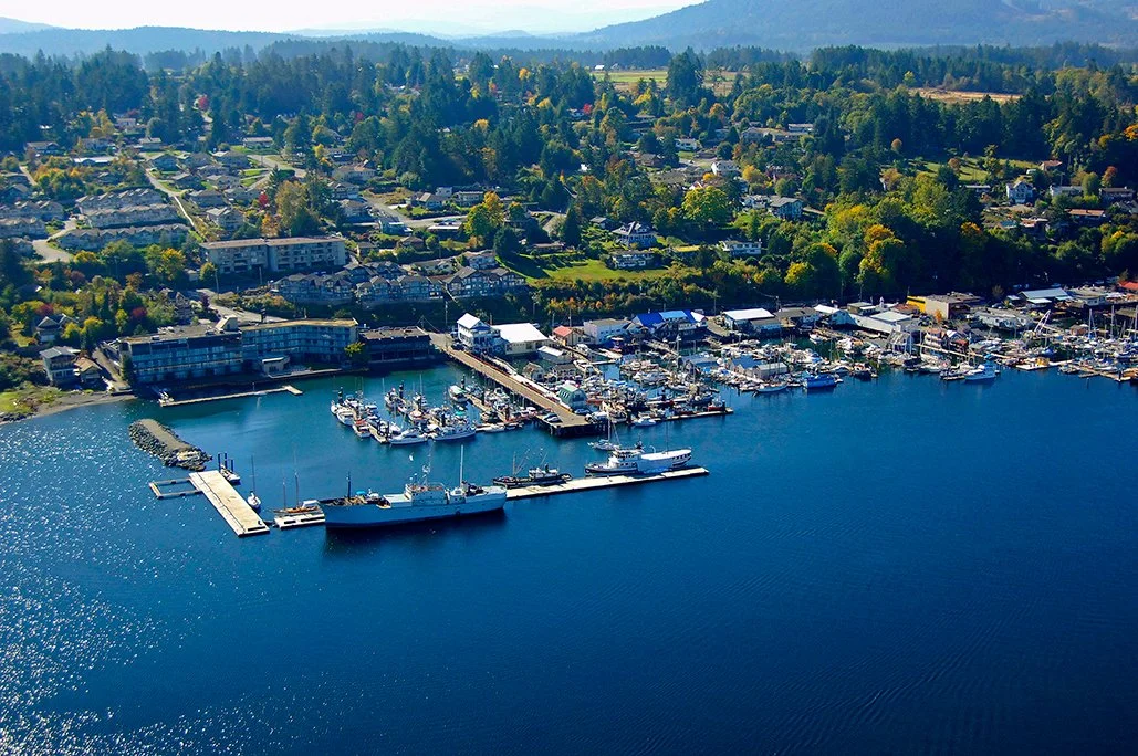
Let’s begin with our own Satellite Channel at the southern entrance to Cowichan Bay...
Satellite Channel forms the southern approach to Cowichan Bay. —marinas.com
You could say that Nanaimo made its mark on Her majesty’s screw corvette Satellite. Which was fair enough, as this 21-gun pioneer left her mark on Nanaimo Harbour charts—Satellite Reef. There’s also Barkley Sound’s Satellite Pass and, closer to home, Satellite Channel, between Salt Spring and Vancouver islands.
Only a year old when she arrived in Esquimalt in 1857, she’d circumnavigated the globe and experienced the Abyssinian (Ethiopia, Eritrea) Campaign, and Japanese civil war en route.
Half a century and half a lifetime later, John Davy’s memories of that voyage remained crystal-clear as he reminisced for a Victoria newspaper reporter:
Christmas Day, 1856, was spent in the Japanese port of Hakodata, then held by rebels and under siege by the emperor’s forces, Satellite clearing harbour for Esquimalt on December 29th. Once out to sea, she and her company were alone, the Pacific at that time being virtually clear of shipping. Just how alone became apparent when the Pacific bludgeoned them with all its might.
“We were battened down part of the time,” Davy said in 1909. “The ropes were frozen and we couldn’t get our main yards down. Much water came inboard as we rolled and the spray fumes froze on the deck. We lost four boats, only [those] lashed inboard escaping being smashed.
“There was no steam steering gear then as now and four men were told off at the wheel, and when the relieving tackles broke broke away they had a trying time, as the wheel jammed and jumped, shaking them about.”
Once, “the rudder chains carried away and we had quite a time fixing them. The saddest feature of the voyage, though, was the killing of the coxwain’s mate when the relieving tackle gave way. The tiller gave a lurch and caught his head between it and the side of the ship...
“We buried him at sea. He was sewn up in a hammock with shot at his feet, and, while as many of the 275 of our company were watching as could be spared, we watched the chaplain read the burial service and saw them slide him overside...”
Satellite survived and, when three weeks out of Japan, sailed into Esquimalt Harbour. Once there, however, she faced a new threat—gold fever!
Before long, no fewer than 75 of her crew had deserted for the Fraser River diggings and “it was a tight lookout for the rest,” said Davy with a laugh.
Then an ordinary seaman, he’d been a “ship’s boy of the first class” when assigned to HMS Satellite, joining her at Annesley Bay. Upon the end of the Abyssinian difficulties she’d been the last of her Majesty’s warships to be reassigned, first to Singapore then to Siam as part of a scientific project.
That completed, the corvette returned to Singaore by way of Bangkok where she was ordered into refit at Hong Kong for the voyage to Esquimalt.
In the course of her nine months on this station, in June 1860, Satellite entered Nanaimo Harbour. Unfortunately for Capt. James Prevost (Mount Prevost), a buoy marker had shifted position and he struck bottom. Damage apparently wasn’t too serious and the incident would have been forgotten if, five years after, while conducting a resurvey of the harbour, Capt. George Richard hadn’t honoured the reef with the name, Satellite.
The corvette’s duties during this busy period weren’t without influence on B.C.’s future as Canada’s westernmost province. At the height of the Fraser River excitement she was stationed at the river’s mouth as an examination vessel, it being her duty to see that all miners proceeding upstream had a license issued by the colonial government.
This point of this requirement was to make an estimated 30,000 American prospectors tacitly concede that they were on British territory and subject to British authority.
Also, Capt. Prevost was at this time a member of the commission formed to settle the San Juan Islands dispute (the famous ‘Pig War’) which established the maritime boundary between B.C. and Washington State.
In 1869 HMS Satellite was back for her second tour of duty in these waters, under the command this time of Capt. W.H. Edye (Edye Passage, Chatham Sound). So, in the 1870s, was John Davy. After 20 more years of war and adventure about the globe, he’d swallowed the anchor—in Victoria which he’d first sighted, as a boy seaman, from the deck of HMS Satellite.
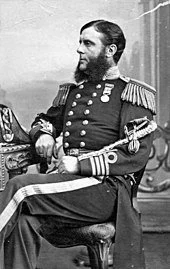
Captain Edye of HMS Satellite, circa 1860s. —Wikipedia
* * * * *
Back to Capt. James Charles Prevost whose name graces the Cowichan Valley’s most prominent landmark, Mount Prevost, which is known to the Cowichan people as Smaent Swuchas, or Smaent Mountain Prevost has four other geographical features named for him.
The Americans have honoured him, too, with Prevost Harbour in the San Juan Islands.
Like his colleague George Richards, Prevost was a dedicated naval officer. When he arrived in B.C. in command of HMS Satellite, he was 47 years old and had been a professional seaman for two-thirds of his lifetime. He’d been here twice before, as a commander aboard HMS Portland, his father-in-law Rear Admiral Fairfax Moresby’s flagship, in 1850, then again in command of the sloop HMS Virago.
The latter posting was during the short-lived but tumultuous Queen Charlotte Islands (Haida Gwaii) gold rush when American miners first invaded B.C. territory. Because of his experience in these coastal waters, latterly in command of HMS Satellite, he was appointed to the British Boundary Commission.
With the assistance of chief surveyor and astronomer Capt. George Richards he negotiated from June through October 1857 with their American counterpart, Archibald Campbell. They were at loggerheads from the start. Prevost, following instructions from London, pushing for a boundary that passed through the more southerly Rosario Strait, Campbell for Haro Strait.
Suffice to say, the British government blinked and the marine boundary ultimately was set as we know it today, to the advantage of the Americans.
In the meantime, Prevost, as commander of HMS Satellite, had his hands full following the orders of Vancouver Island colonial governor James Douglas to try to administer a modicum of control over the onslaught of American miners to the Fraser River diggings. In the absence of troops, it fell to the handful of ships of the Royal Navy to establish law and order on the B.C. Mainland.
When the mining excitement began to subside, Prevost returned his attention to boundary matters and it was upon his advice to the Admiralty that Esquimalt Harbour became a permanent naval base. When, after 12 years of negotiation and arbitration, the international boundary was formally set as we know it today, it was done against Prevost’s professional advice.
He was long gone from B.C. by then. After serving as superintendent of the naval establishment at Gibraltar he was promoted to vice admiral in 1876 and admiral in 1880 although he’d long given up going to sea. He died in 1891, aged 81.
* * * * *
I mentioned that Admiral Sir George Henry Richards (1820-1896) was a modest man.
As the Second Commissioner of the British Boundary Commission which delineated the border from the Pacific to the Rockies, he had every advantage available to him to christen some majestic B.C. geographical feature for himself. It remained for the Geographical Names Board of Canada to correct that, both in British Columbia where he laboured as a naval hydrographer, and in Alberta’s Waterton Lakes National Park.
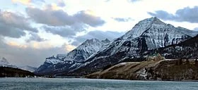
Since 1943 the latter, aka Sleeping Indian Mountain and situated near the Canada-U.S. border, is a more fitting tribute to this dedicated officer. At 2377 metres (7799 feet) with its snow-clad peak, it certainly is more imposing than the Cowichan Valley’s nondescript, 337-metre Mount Richards.
(In my previous mentions of Sir George, descendants of the local pioneering Richards have made it known that they believe Mount Richards to be named for their family. There’s no doubt that Richard’s Trail, between Herd and Westholme roads, owes its provenance to their ancestors.)
Mount Richards, Waterton Lake National Park.


