Editorially speaking…
As its name implies, the BC Chronicles is meant for a province-wide audience, so I try to vary stories by area and by subject; usually, that isn’t a problem.
But I must apologize for this week’s and next week’s posts being Vancouver Island oriented, made necessary by my having to write three Chronicles back-to-back to allow my graphic artist a week away. It’s not a matter of lacking material but that of what’s readily accessible in the least amount of time.
After next week, something for Mainland readers, I promise!
* * * * *
Now the company that wants to salvage whatever valuable minerals are left in the ore dumps of the Tyee and Lenora mines on the Cowichan Valley’s Mount Sicker is looking to process the tailings piles of the Blue Grouse Mine.
Jennifer and I made several visits to the adjoining Blue Grouse and Sunnyside claims on the west shore of Cowichan Lake years ago, I’m happy to say, so it isn’t on my bucket list, or I’d be champing at the bit to check it out before they can go to work.
Copper was this mine’s greatest asset with lesser amounts, in order of quantity, silver, gold and zinc.
Thanks to the BC Department of Energy, Mines and Petroleum Resources’ online Minfile, I can tell you all about it without raising a sweat:
“The Blue Grouse mine is located on the south side of Cowichan Lake, 4.8 kilometres northwest of Honeymoon Bay. Mineralized outcrops on the property were first located between 1900 and 1910. The mine was abandoned in 1960, reportedly leaving some reserves. The workings were rehabilitated in 1979 by Corrie Copper Ltd. Copper mineralization of mineable grade was reported to be present at the 1100 level. The workings were back-filled sometime between 1987 and 1989. The Sunnyside workings (092C 108) are located 800 metres to the south.
“The mine was in production from 1917 to 1919 and from 1956 to 1960. From 249,298 tonnes of rock, 6,814,623 kilograms of copper, 2,508,644 grams of silver and 218 grams of gold were produced. Exploration in 1989 located several gossanous zones in the southwest portion of the property...
“Sampling results ranged from 0.0007 to 1.1824 per cent copper and 0.001 to 0.043 gram per tonne gold (Assessment Report 19387). In 2002, Ber-Can Environmental Resources Inc. completed a program [of] geo-chemical sampling of the Blue Grouse tailings and tailings ponds for the purpose of developing a proprietary process for the clean up of mine tailings and mill tailings.”
Which obviously hasn’t been done or the mine wouldn’t be in the news today.
* * * * *
Coincidentally, and also in the Cowichan Valley, the Municipality of North Cowichan is looking at reclaiming the Crofton Harbour shoreline from smelter operations, a century-plus ago.
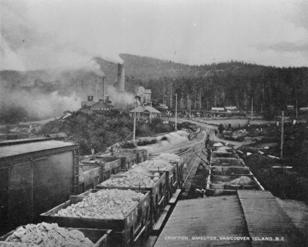
An RV park now sits on the site of the historic Crofton smelter. The Municipality of North Cowichan is looking into removing the remaining slag from the harbour shoreline. —BC Archives
I don’t know what harmful chemicals can leach from partially smelted ores, so I can’t comment on a scientific basis. I can say that I’ve made several visits to the man-made spit that runs out from the RV park where the smelter was located, looking for attractive rocks, some of which resemble obsidian and some have a rainbow sheen. They go nicely with the various ore samples in my collection.
Just as well, perhaps, as I guess there won’t be anything left if the municipality follows through.
* * * * *
Liz Hammon-Kaarremaa, author and researcher of Coast Salish spinning history, was in Duncan this week, signing copies of her bestselling book, The Teachings of Mutton: A Coast Salish Woolly Dog.
The woolly dog that’s the subject of her book was raised by Coast Salish people for its woolly coat which was used, like that of sheep, for making blankets, robes and regalia. ‘Mutton,’ by the way, really existed. The only confirmed woolly dog specimen’s pelt is in the Smithsonian since his death in 1859 after it “lay forgotten in a drawer for 160 years”!
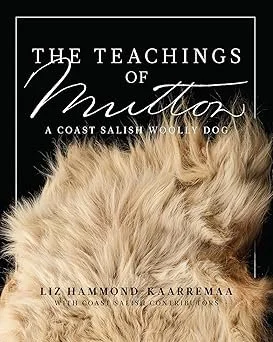
What a shame that this remarkable breed is now extinct. But what a blessing that its story has now been told by Liz Hammon-Kaarremaa and is probably available at your local bookstore.
* * * * *
Further to this being National Indigenous History Month, there was a news feature in March about Melinda Quintero, a student from the U.S. who, upon moving to Victoria, went in search of Indigenous history, but was stymied.
So she decided to create a map. “I had that moment of, like, gosh, I guess if you want something done you’ve got to do it yourself,” she told the Cowichan Valley Citizen.
Using published but scattered resources she has created an online database, mapping over 100 landmarks with their traditional Lekwungen place names of cultural significance to the Esquimalt and Songhees First Nations.
As an example, she noted that Victoria’s Beacon Hill Park is Meeqan in Lekwungen. It means a place where you can lie in the grass and soak up the sun!
“That speaks more to the nature of the land than Beacon Hill,” so-named because it was the site of a navigational aid, she said.
* * * * *
Again, week after next, it’s back to the Mainland!
* * * * *